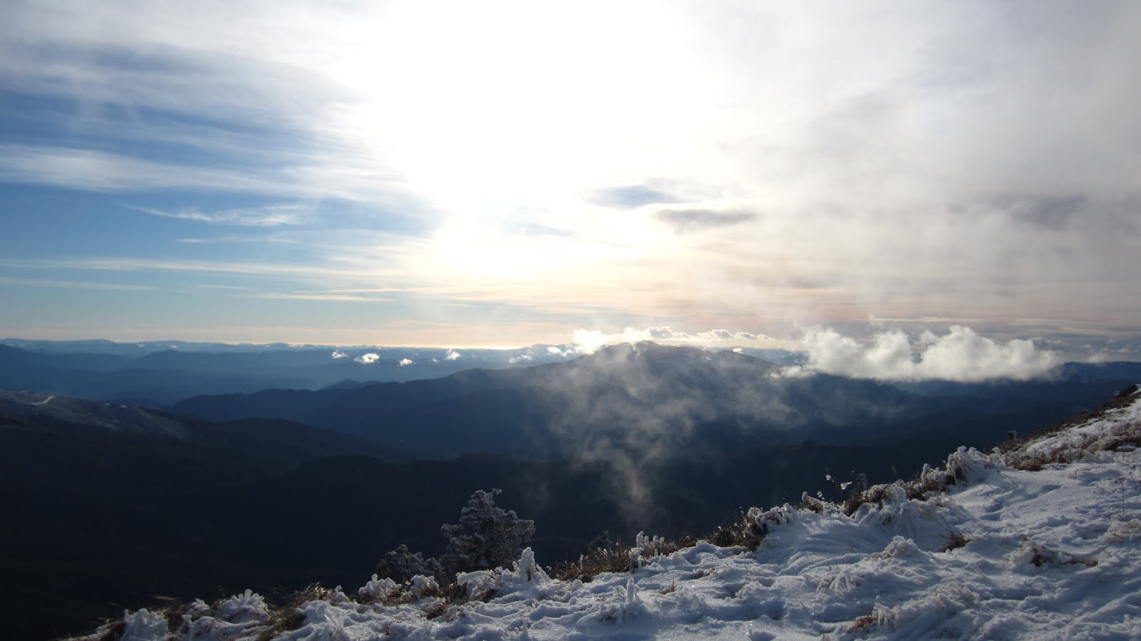
Remember back in the summer when we were complaining that it was too hot? Yeah, we shouldn't have done that.
October sucked in regards to weather and we broke records for high levels of rainfall. November didn't shatter any records but, while it was drier than October, it was still quite wet. December can't seem to make up its mind. Should it be 45˚F (7.2˚C) and rain, or maybe 32˚F (0˚C) and freezing rain or random snowflakes?
As I sit at my computer, the boss having sent me home at 1:30 pm worried about road conditions, it is slushing outside. Not really snow, not quite hail, not quite rain, and it is adding up. The below photo was taken around 2:30 this afternoon through our living room window with my iPhone.
 |
| (Fiat in our driveway, an inch of slush will shut down the town) |
All this wet weather hasn't been very motivating to hop on two wheels, but it does make us think fondly of that warm summer weather.
Back in August
Troubadour and I didn't make big plans for our 20th wedding anniversary. Not only did it fall mid-week while we were working, but we just couldn't think of anything grand to do with the summer heat. Instead we chose to go play at the coast that Friday. Not an overnighter just a day on the sand.
I never posted a blog about it so I thought I'd post about it now as I reflect fondly on the warm summer sun.
FRIDAY AUGUST 12, 2016
We left
Corvallis and headed southwest along Highway 34 to the coast. The pace wasn't very fast since the ODOT was doing some seal coating/chip seal along the way. We took the Fiat 500 so we could pack along picnic supplies, blankets, and the kites.
We arrived in
Waldport on Highway 101 and turned south to
Yachats to enjoy lunch at the
Green Salmon Cafe. One of the only places to get vegan eats in the land of seafood. While most of it is assembled from prefab processed foods, at least it is an option. We sat outside in the beautiful sunshine. Not as warm at the coast compared to the heat of the valley. I had the Tempeh Reuben sandwich while Troubadour partook of the Tofurkey Italian Sausage. We may have purchased a few vegan danishes to go as well.
 |
| (My Tempeh Reuben sandwich - Green Salmon cafe, Yachats) |
 |
| (Troubadour's Tofurkey Italian Sausage, Green Salmon Cafe, Yachats) |
From Yachats we drove south on Highway 101 along the coast and stopped at one of our favorite little hideaway beaches. The wind was up, but the sun was out, and the sand was warm on our bare feet. Not too hot, and not too cold.
 |
| (Summertime at the Oregon Coast) |
As we broke out the kites, the mist started to roll in, which made for some interesting pictures. Warm sand and a cool breeze was a good combination.
 |
| (Mist rolling in) |
 |
| (Troubadour flying his kite) |
 |
| (Even more mist rolling in) |
 |
| (Hold on Troubadour) |
While Troubadour was flying his kite I decided to explore the sea critters along the large rock closer to the water. The rock was covered in barnacles and mussels, and around the base at sand level were the sea anemones. Here is a link to a pdf guide titled
Oregon's Rocky Intertidal Areas "tidepools" published by Oregon State Parks.
LINK
 |
| (Looking down at the California mussels and Gooseneck Barnacles) |
 |
| (Anemones close until the tide comes in to conserve moisture) |
 |
| (All different shades of green) |
As the sun was blocked out by the mist, we started getting a little chilly from the wind and decided to head back to the car and check our guide book for hikes on the coast instead.
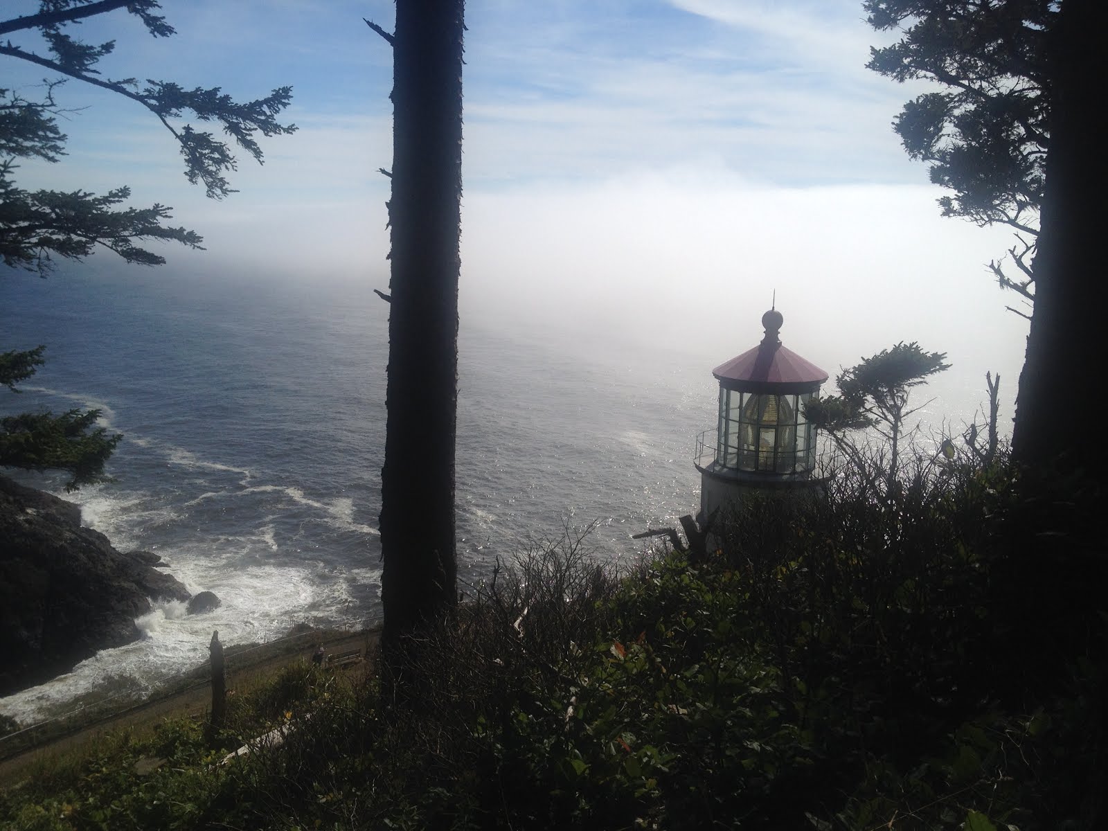
We discovered where there was a hiking trail to get to
Heceta Head Lighthouse. Heceta is pronounced "huh-see-tah". You park on the side of the highway and hike a 2.6 mile round trip route (4.18 km) rather than driving further south and parking at the visitors center/State Park. Sounds good. I can't count how many times we've driven down Highway 101 and never knew about it.
Heceta Head is located 13 miles north of the city of Florence.
Heceta Head is the most photographed of all of
Oregon's 11 Lighthouses and was built in 1894. "
Bricks for the tower were shipped from San Francisco to Florence and hauled over the hills on wagons. The 2-ton Fresnel lens, with 640 delicate, hand-ground prisms was off-loaded onto the cape by surf boat."
You can visit all but one of Oregon's Lighthouses - the infamous Tillamook Rock Lighthouse, which is located 1.2 miles (1.9 km) offshore.
LINK on more info on that one.
As we were getting out of the car I discovered my camera battery had died so the remaining pictures are all courtesy of
Troubadour and his iPhone 4s.
 |
| (Trail to Heceta Head Lighthouse from Highway 101) |
 |
| (Sunshine and mist filtering through the trees) |
 |
| (Nature's Majesty.....so pretty) |
I never realized that there was such a hill climb between the highway and the ocean. Up and up we climbed. There were even several sets of stairs. It is quite damp and muddy in some areas and others where the sun would come through were dry.
 |
| (We always manage to find mushrooms on our hikes) |
Here and there along the trail were spur trails leading to views of the Pacific Ocean.
 |
| (View of the Pacific Ocean north of Heceta Head Lighthouse) |
After some huffing and puffing we caught our first view of the lighthouse.
 |
| (Heceta Head Lighthouse, Oregon) |
 |
| (A zoomed in view) |
 |
| (Down a path and we arrived at the lighthouse and oil shed) |
 |
| (A view at the base of the lighthouse) |
 |
| (A view of the Pacific Ocean from the lighthouse) |
Unfortunately we arrived too late in the day to actually climb to the lens of the lighthouse. From the lighthouse point we could look a little south towards the highway and visitor's center and the old caretakers cottage, rumored to be haunted.
 |
| (Old caretakers cottage and Highway 101 over Cape Creek Bridge) |
We decided to walk towards the Visitor's Center and the Bed &Breakfast, which was actually one of the old caretaker's homes.
 |
| (Trobairitz and the caretakers cottage - there used to be two residences inside the fence) |
From the cottage we could look back up the winding road to the lighthouse.
 |
| (Heceta Head Lighthouse viewed from caretakers cottage) |
 |
| (A view showing the terrain to get to the lighthouse) |
 |
| (The thistles were in full bloom along the road between the cottage and lighthouse) |
 |
| (One last look at the lighthouse as we hiked 1.3 miles back to the car) |
By the time we returned to the car our bodies informed us that we hadn't done near enough hiking this year. Heading south into Florence we pondered whether to drive to Eugene for dinner. Thinking of city traffic on a Friday night we opted to take Highway 36 around Triangle Lake. We stopped along the way for a picnic dinner and those vegan danishes from the Green Salmon for dessert.
We arrived home around 8:30 pm. Tired but we'd had a good day. Fond memories as I sit here and look outside at the slush adding up.
- Au Revoir
" Those who can laugh without cause have either found the true meaning of happiness or have gone stark raving mad." - Norm Papernick
.


