Pages

Wednesday, August 16, 2017

Anniversary Dual Sport Ride

Last Thursday August 10th was our 21st wedding anniversary.  We both took the day off work to go for a motorcycle ride.  What better way to celebrate the day, than on two wheels with a picnic lunch.

The night before we were both looking at different maps trying to link together some gravel roads in the foothills west of Corvallis.  Troubadour and I left the house about 11 am and fueled the bikes in Philomath and headed west on Highway 20 then turned north on Kings Valley Highway.  We stopped at the Ritner Creek Covered Bridge for a quick break and to look at the maps again.

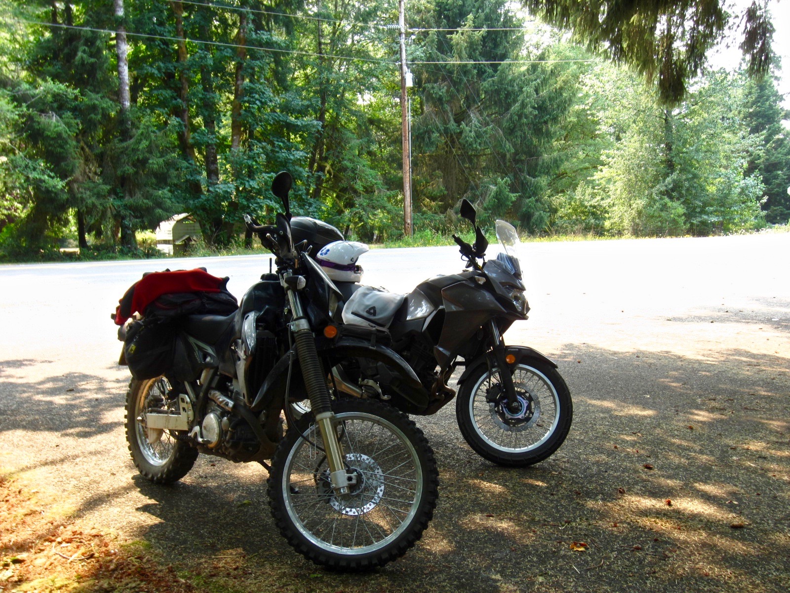
(DRZ 400 and the Versys 300x)

(Ritner Covered Bridge)

(Versys 300x, notice we've taken the Kawi stickers off the front fairings)

We went north a mile or so further before turning left onto a gravel road.  I haven't done a lot of gravel on the Versys but so far it is way better than the Gladius ever was off tarmac.

Unfortunately we couldn't get to where we wanted to go.  The forestry service is closing all of our back roads and gravel roads due to fire danger and the upcoming solar eclipse on Monday August 21st. We are in the path of totality and the State is expecting one million visitors for the event.  (Update - why we aren't leaving the house for the weekend and Monday-Tuesday next week - LINK)

We re-routed and ended up at Fort Hoskins where we took another short break, snacked on bananas and tried to determine what roads might be open.

From Fort Hoskins we took Hoskins Road, a 9 mile long gravel road, to link us to Mary's River Road and and the Summit Highway - another twisty bit of tarmac.    Luckily the loaded log trucks behaved themselves and stayed to their side of the narrow road.

(Fort Hoskins to Summit Highway - the blue route)
Once on the Summit Highway we were on one of the roads we drove while in the Fiat the weekend prior, which also had a stretch of gravel a few miles long.

We went to Moonshine Park to check out the camping section and thought we'd have our late lunch there.  Unfortunately it was $3 a vehicle to park and it was really busy and almost uncomfortable really.  

(Summit Highway to Moonshine Park)
We were hoping to go north, but once again the gravel road we wanted was closed, so we had to adapt our route and went southwest again instead.

We headed west through Logsden towards Siletz and found the Twin Bridges Memorial Park where we stopped for half an hour or more.

(Moonshine Park to Twin Bridges Memorial Park)

(Twin Bridges Memorial Park - Lincoln County)

(A picnic in the park - everything is nice and green in the coastal mountains)

(The bikes having a rest in the shade)

(Suzuki DRZ 400 and Kawasaki Versys 300)

(A nice little spot to rest on a sunny day)

From the park we did another 5 mile stretch of gravel on Sams Creek Road to connect with Highway 20.  At Highway 20 we turned east towards Eddyville and then took Highway 180 the long twisty way to Blodgett, which is back on Highway 20. We try to stay off the main highway as much as possible and prefer the twisty back roads that kind of parallel the highway in sections.

(Eddyville to Blodgett)
At Blodgett we took Highway 20 east to Corvallis (13 miles) and were back at the house by 5 pm. Our total for the day was 6 hours and 113 miles (181 km), a nice relaxing afternoon.  

Now the Versys really needs a bath, it is completely covered in road dust from following Troubadour over the gravel roads, but at least it was earned dirt and not from sitting in the garage.

I do wish I had of stopped a few times along the gravel roads and taken pictures to show you the conditions and scenery, but I know for next time.

It was a good day to be out on the bikes together.

- Au Revoir

" A wedding anniversary is the celebration of love, trust, partnership, tolerance, and tenacity.  The order varies for any given year." - Paul Sweeney
.

Wednesday, August 9, 2017

Drift Creek Suspension Bridge

We've been experiencing quite a dry spell here in Oregon with no measurable rain in the valley in two months.  A far cry from the 50 inches of rain we experienced last winter.  We've seen average temperatures in the high 80's to low 90's and one heat wave where we saw temperatures soar to 109˚F (42.77˚C).  We haven't been doing too much in the way of riding.  A few forest fires have sprouted up around Oregon and combined with the smoke from the fires in Washington and British Columbia we've had air advisory warnings whenever the winds shift.

On Sunday August 6th we did decide to take the Fiat and heat northwest towards the coast for a little hike. We'd been reading about the Drift Creek Suspension Bridge and Drift Creek Falls for quite a while now and decided it might be time to check it out. They are located just east of Lincoln City in the coastal range, approximately 9 miles up a windy one-lane forestry road from the Drift Creek Covered Bridge which I blogged about back in June 2011 in this post ---> LINK.

The drive up was fine and we managed to find a place to park in the parking lot, not on the side of the road like some folks had to do.  The trail is 3 miles (4.8 km) round trip and an easy hike - trail map LINK.  Unfortunately, when it is an easy hike it is classified as family friendly and is busy.  A lot busier than we expected for 1:00 pm on a Sunday afternoon.  Note to self - only do moderate and difficult hikes on the weekends.

The trail is a winding path through the woods, 1.5 miles (2.4 km) downhill to the creek.  We stopped for a few pictures on the way down.

(Heading down the hill - nice easy trail)

(Nature was reclaiming some of the downed trees)

(We crossed a few small bridges)

(Which meant creek crossings - water level is low)

(Interesting stump of a decomposing redwood tree)

At the 1.25 mile marker you arrive at the suspension bridge. The suspension bridge was built in 1997, is 3 ft wide, and spans 240 feet (73 meters) across the canyon. More info about the building of the bridge HERE.

(Our first view of the bridge)

(Troubadour on a suspension bridge)

(Me on the bridge - photo by Troubadour)

(Looking over the edge at Drift Creek Falls - not a lot of water this time of year)

(The other end of the bridge)
Because of other hikers we couldn't linger on the bridge.  Once on the other side we walked towards the edge a little for a better view of the falls and the span of the bridge.

(Drift Creek Suspension Bridge)

(Drift Creek Falls and Suspension Bridge)

(Troubadour pondering the falls)

(Photo by Troubadour - he turned around and caught me with the camera)

(I figured I'd stop being cheeky and stand up)
From here it was a short 0.25 mile downhill walk to the creek.  Unfortunately we'd found the rest of the people bottle necked at the rocky shoreline.  We chose not to linger, but instead turned right around and started hiking back up towards the bridge as fast as we could to get out of the way.  We were surprised at how many people were heading down there.

It was a pretty easy hike on the way back up and we were actually catching up to people.  We stopped  at the bridge to wait for folks to cross and Troubadour ventured a little closer to the edge of the canyon for one last picture of the falls.

(Drift Creek Falls, Lincoln County, Oregon)
We made it back to the trail head in what felt like record time.  For some reason it didn't seem to take us as long going up the hill as it did going down.  Usually it is the other way around.

Once at the trail head we had a snack and decided to follow the one-lane forestry road 16 miles west to where it intersects with Highway 101 along the coast.  It was a beautiful road, perfect for motorcycles with a lot of gravel spur roads just begging to be explored (just not in a Fiat 500). We definitely need to go back on two wheels for closer examination of those gravel roads.

We took our time getting to the coast, and after a short half a mile of coastal traffic turned southeast on Highway 229, the Siletz Highway.  A nice twisty way to avoid the tourist traffic on Highway 101.  We hadn't been on this highway since July 2013 (blogged about it HERE) and had forgotten how much fun it could be.  At Siletz we turned east on Highway 410, the Logsden Road. More twisties and even a stretch of gravel made us wish we were on the bikes.  One more turn east onto Highway 180, the Summit Highway took us Blodgett, Highway 20 and home.

We arrived home just before 7 pm.  It was a nice relaxing day, although we decided we had more fun exploring the back roads than on the actual hike.

- Au Revoir

"There's sunshine in the heart of me, 
my blood sings in the breeze;
The mountains are a part of me,
I'm fellow to the trees." - Robert W. Service, "A Rolling Stone" (1912)
.